The parkway is open all year, but sections close for snow, road projects and vegetation work. This timeline shows what to check each season and when to reserve rooms.
Road notes
- The Blue Ridge Parkway is open 24 hours a day, 365 days a year, but individual sections close for weather, construction and vegetation work.
- High-elevation sections close each winter for snow and ice and reopen only after natural melting, since the road is not plowed or chemically treated.
- Fall color starts on the highest peaks and finishes in the low valleys, with mid to late October the usual window to catch sections near peak.
- Book October lodging well in advance, and check the daily road status chart before each driving day because it is not real time.
- There are no gas stations on the parkway, and the speed limit is 45 mph for the full 469 miles.
The Blue Ridge Parkway is open 24 hours a day, 365 days a year, but that does not mean every mile is drivable every day. Weather, road projects and vegetation work close sections on a schedule that repeats year after year. Timing a parkway drive well comes down to knowing when gates come down, when color peaks and when rooms near the road sell out. This timeline runs through the calendar and tells you what to check at each stage.
Why the Parkway Runs on Its Own Calendar
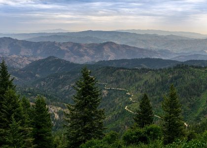
The road covers 469 miles and climbs through a huge elevation range, from just under 650 feet at the James River in Virginia to over 6,000 feet south of Mt. Pisgah in North Carolina. That range drives everything else. Snow lingers on the ridges long after it melts in the valleys, contractors get only a short construction season in the high country, and the National Park Service runs a rolling program of repair projects backed by more than $200 million in Great American Outdoors Act funding. The parkway welcomed 16.7 million visitors in 2024, so demand shapes timing too.
A few ground rules before you pick dates:
- The speed limit is 45 mph for the entire route. There are no stop signs or traffic lights, but this is not a freeway.
- There are no gas stations on the parkway. Fill up on an intersecting highway before you get on.
- The official road status chart is updated daily but is not real time, and status can change after the morning update. Sections marked ungated have no gates at all and stay open except in emergencies.
Winter: Sections Close and Wait for the Snow to Melt
Winter is when the parkway’s own calendar matters most. Many sections close for long periods because of snow and ice, and the closures change daily. Crews do not plow or treat the road with chemicals, so closed high-elevation sections reopen only after natural melting. A warm week in the valleys will not open the ridges.
If a winter drive is on your mind, check the National Park Service road status page the morning you go, and again each day of a multi-day trip. The parkway information line at (828) 298-0398 carries closures and weather reports, and 1-800-PARKWATCH is the number for emergencies along the road. Lower-elevation stretches usually hold the most open miles, but there is no fixed list of what will be open. The chart is the answer.
Early Spring: Wildflowers and the Start of Construction Season
As the snow melts, gates lift section by section and the construction season starts. In many high-elevation areas contractors have only a short window to work, so road projects stack up in spring and summer.
In 2026, road and pavement reconstruction is scheduled between mileposts 95.9 and 121 in the Roanoke, Virginia area, one of several parkway projects funded through the Great American Outdoors Act. The stretch from milepost 95.9 to 106 is already complete, the section between mileposts 106 and 112 is scheduled to open on June 19, 2026, and work continues through milepost 121 over the summer. Bridge maintenance between mileposts 121 and 147 is targeted to start in fall 2026 and wrap up in spring 2027. Hurricane Helene recovery work also continues along the route, so check the parkway’s construction projects page for the affected areas in the year you travel.
Careful
During pavement preservation work, bicyclists and motorcyclists have been advised to use alternative routes while the treatment cures, because loose gravel on fresh pavement creates hazardous conditions. Check project notices before riding these stretches.
Summer: The Most Reliable Miles, With Detours to Plan Around
Summer brings the fullest access of the year. Most miles are open, though the status chart often shows brief single-lane closures tied to ongoing projects. In 2025, three bridge deck replacements and a landslide repair in Alleghany County, North Carolina came with a signed detour on NC 18 between mileposts 221.8 and 230, and the Laurel Fork Bridge area from milepost 248.1 to 249.3 closed to all activity during construction. Work on a new parkway bridge over the widening of I-26, near milepost 391, is also underway. The lesson is that summer access is good but rarely total, so match your plan to the current chart.
Two summer details worth planning around:
- Temperatures can vary by as much as 20 to 30 degrees along the drive because of elevation. At the highest points, the hottest summer days only reach into the 70s, so pack a layer even in July.
- Fifteen visitor centers line the route, which makes summer a good season for breaking a long drive into shorter days.
Fuel is part of the plan too. With no gas on the road itself, our road trip fuel budget guide helps you price the detours off the parkway for fill-ups.
Late Summer: Book October Lodging Before You Forget
If a leaf season trip is on your list, this is the stage to act. For overnight trips during October, the parkway’s own travel guidance is to reserve lodging well in advance, because rooms in towns near the road fill up for the color season. Campgrounds deserve the same treatment: pick dates and book rather than assuming a site will be there.
This is also a good moment to sketch the route by milepost. The zero milepost sits at the north end in Virginia, and the numbers increase as you drive south, which makes it easy to match overlooks, visitor centers and closures to specific stretches.
Fall: Leaf Season and Peak Color by Elevation
Peak color follows elevation. Leaves start changing on the highest peaks and finish in the low valleys, so there is no single peak date for the whole road. Mid to late October is the usual window, but the parkway spans east- and west-facing slopes across that 650 to 6,000 foot range, and no simple formula predicts color. Bright, sunny and cool days, cool nights that stay above freezing and adequate rainfall produce the best displays. Wet, cloudy, warm weather or an early hard freeze mutes it.
The most useful planning advice comes from the parkway itself: instead of driving to one spot on one day, cover some distance along the route and change elevation and north-south orientation as you go. Travelers who do that in mid to late October are likely to catch at least some sections at or near peak. Check the webcams linked from the parkway’s fall color page in the days before you leave to see what each region actually looks like, and expect heavy traffic at popular spots during leaf season. Build slack into each day instead of a tight schedule.
November: Boom Axe Season and the Road Back to Winter
Two things converge in November. First, annual vegetation control begins. Parkway crews run boom axe tractors that cut the banks and shoulders, and both lanes close to all traffic in active work zones. These closures run on weekdays from 8 am to 4 pm, continue through early spring, depend on favorable weather, may not appear on the official closure chart and usually have no signed detour route, so patience around the tractors is part of the deal. Second, the season’s first lasting winter closures begin to show up on the high ridges, and the cycle that opened this timeline starts over. Check the chart each morning you drive, keep the tank topped off for detours, and let the parkway’s calendar, not the one on your wall, set the plan.
For the bigger picture, our guide to planning a scenic byway trip explains how parkways and mountain routes differ from ordinary highways, and it pairs well with our winter mountain driving article if a shoulder-season trip has you on the ridges in cold months.
Questions from the road
Q: Is the Blue Ridge Parkway open year round?
A: The road never closes seasonally as a whole, but sections do close for snow and ice, construction and emergency events. Check the National Park Service road status chart before each day of driving.
Q: When is peak fall color on the Blue Ridge Parkway?
A: Color starts on the highest peaks and finishes in the low valleys, and mid to late October is the usual window. Driving a long stretch while changing elevation gives you the best odds of catching peak color somewhere.
Q: Are there gas stations on the Blue Ridge Parkway?
A: No. Fill up on intersecting highways before you enter, and plan detours off the road for refueling on longer runs.
Q: What are boom axe closures?
A: Annual vegetation cutting that closes both lanes in active work zones on weekdays from 8 am to 4 pm, from November through early spring. These short closures may not appear on the official chart and usually have no signed detour.
Road rules, fees, closures and border requirements change. Check with the state transportation department, park, rental company or border agency before you travel. This guide is general information.